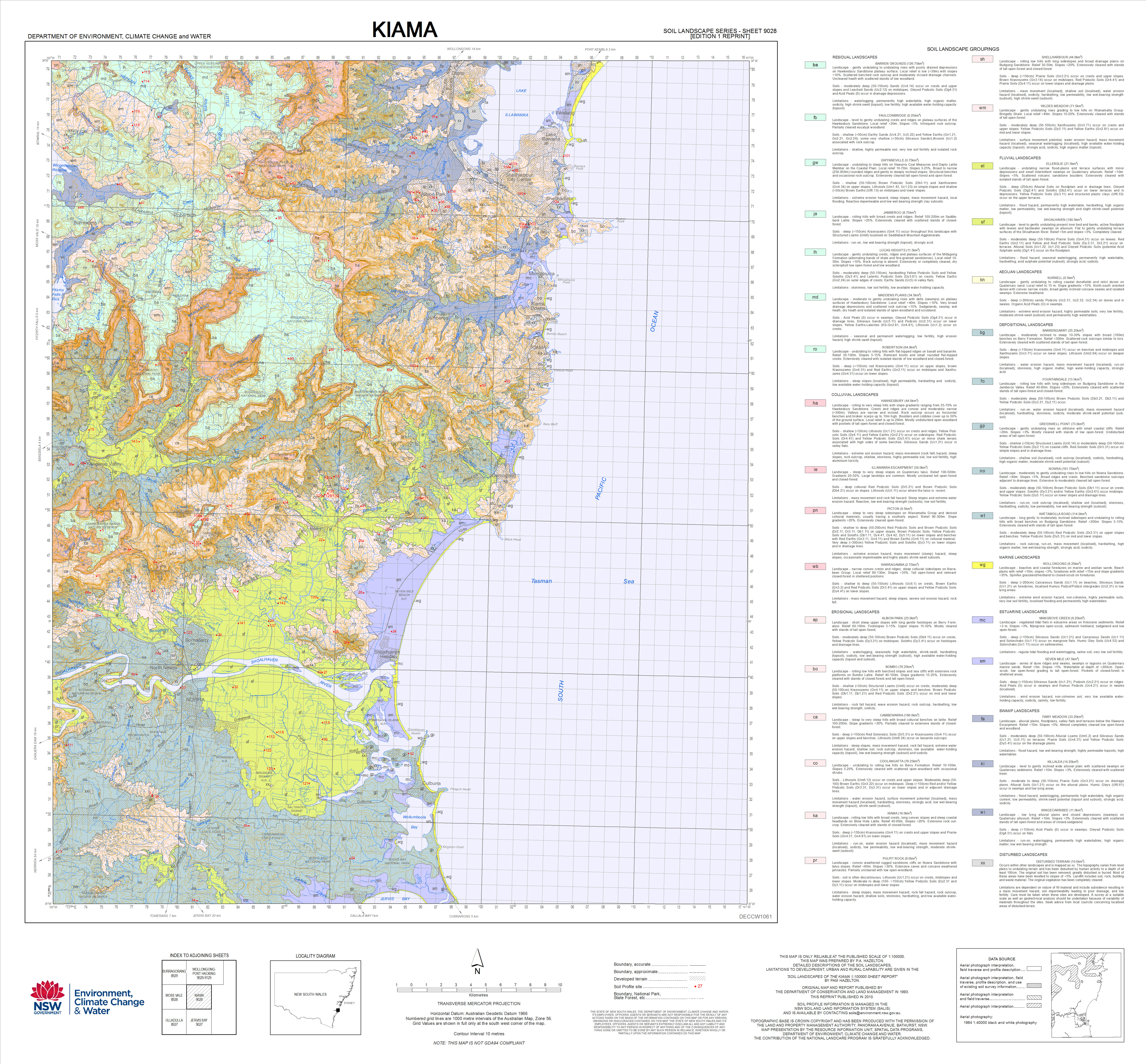
Soil landscape map
Source
This data file or API can be downloaded from:
https://datasets.seed.nsw.gov.au/dataset/7d92ae87-d3a7-4cf2-b5bd-ce1214ed2301/resource/1543d470-ba12-4951-944a-09b35d77be4c/download/kiama9028ed1reprintsoillandscapemap.jpgResources
There are no views created for this resource yet.
Additional Information
| Field | Value |
|---|---|
| Data last updated | unknown |
| Metadata last updated | October 18, 2025 |
| Format | JPEG |
| License | Creative Commons Attribution 3.0 Australia |
| Datastore active | False |
| Datastore contains all records of source file | False |
| Has views | False |
| Id | 727953be-aef5-41f6-bbf0-23d792b28be5 |
| Mimetype | image/jpeg |
| Package id | 2c8ba615-99dd-457f-b531-4a6b7c37eab5 |
| Position | 5 |
| State | active |
| Zip extract | False |
| Size | Unknown |
| ID | 727953be-aef5-41f6-bbf0-23d792b28be5 |
| Harvested | True |
| Package ID | 2c8ba615-99dd-457f-b531-4a6b7c37eab5 |
| State | active |